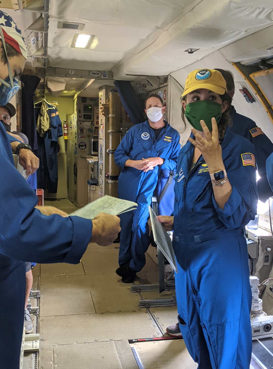
Taking flight from Lakeland, Air Force Maj. Ashley Lundry led a Hurricane Hunter aircraft crew Wednesday night as they flew five passes through 150-mph Hurricane Laura, collecting critical forecast data hours before the monstrous storm made landfall.
“It was intense. It was a very, very strong hurricane. Our first pass through, we entered from the northeast side of the storm — and it was a bumpy ride getting into the center," Lundry said.
"When we got into the center from the eyewall, everyone describes it as ‘the stadium effect.’ I think the clouds were 50,000 feet high. It was completely open, and you could see the calm winds on the surface," she said.
"And then as you looked up, you actually had to kind of crank your head up looking out the window to see the path of the clouds. They were that high," she said.
More: 'I didn’t know it was going to be this bad': Cameron Parish, Louisiana, bears brunt of Laura's wrath
Lundry attended the Florida Institute of Technology on an Army ROTC scholarship, earning a Bachelor of Science degree in meteorology in 2006.
The past week, she served as flight director for six National Oceanic and Atmospheric Administration weather reconnaissance missions into Laura. She flew aboard Miss Piggy and Kermit, the agency's two Hurricane Hunter WP-3D Orion turboprop planes.
Lundry first visited Laura when the storm was merely Tropical Depression Thirteen, which formed on Aug. 19. That's when the system was still located about 1,035 miles east-southeast of the Northern Leeward Islands, packing maximum sustained winds near 35 mph.

Taking flight from St. Croix in the U.S. Virgin Islands, Lundry said Tropical Depression Thirteen had multiple areas of circulation, so it was challenging to pinpoint the center of the system. Miss Piggy's tail Doppler radar system took vertical scans of the disorganized storm, which were used to initialize forecast models. National Hurricane Center meteorologists also used this data to create a near-real-time 3D model of the storm.
More: Hurricane Laura coverage: As historic storm moves inland Louisiana, forecasters warn of 'life-threatening storm surge'
By the time Laura entered the Gulf of Mexico, Lundry said the hurricane strengthened into an entirely different animal.
“When we flew the storm Tuesday night, compared to (Wednesday) night, we probably saw a 40-millibar pressure decrease — and then the winds increased over 50 knots. The storm had just started going through the rapid intensification stage between our fifth and our sixth flight," Lundry said.
"It was just a completely different storm," she said.

This marks Lundry's second season with the NOAA Hurricane Hunters. In tandem, she has also logged six years as an aerial reconnaissance weather officer with the Air Force Reserve's 53rd Weather Reconnaissance Squadron Hurricane Hunters, which fly WC-130J Super Hercules planes from Keesler Air Force Base in Biloxi, Mississippi.
Born in Virginia Beach and raised on Florida’s Panhandle, Lundry was attending Florida Tech during the Space Coast’s historic 2004 hurricane season. She recalled how Hurricane Charley swept past in August while she was moving onto campus — and then Hurricanes Frances and Jeanne caused widespread damages in September.
“I think we ended up with almost two weeks out of class because of storms. That was a pretty interesting semester," Lundry said.
"As a meteorologist, it was an incredible learning experience to be watching the forecasts, and to have our professors teach us what was going on," she said.
After graduating and serving four years as a logistics officer in the Army Reserve, she became an Oklahoma Air National Guard weather officer in 2010.
She earned a master’s degree in physical science from Emporia State University in Kansas in 2013, then transferred to the 53rd Weather Reconnaissance Squadron the following year.
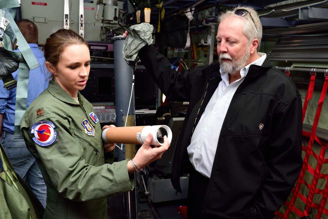
Equipped with radar systems and microwave radiometers, NOAA Hurricane Hunters brave violent turbulence flying low-altitude missions into the center of hurricanes and tropical storms, measuring central pressure and surface winds around the rotating eye.
"What goes into a lot of our model data is initial conditions. When you have a system — especially that's over the water — you're not getting a lot of observations. So the Hurricane Hunters are incredibly important," said Derrick Weitlich, a meteorologist at the National Weather Service station in Melbourne.
"All of the dropsondes and additional data they collect when they fly into one of these systems can be incorporated into our model forecasts. The more observations that we have, the more data that we have," Weitlich said.
"That's incredibly important to get our intensity forecasts and track forecasts to improve," he said.
More: COVID-19: Hurricane director warns Floridians to prepare for busy storm season, virus
Dropsondes are tube-shaped probes that Hurricane Hunters deploy as they fly through a storm. These instruments continuously transmit measurements of air pressure, humidity, temperature, wind direction and wind speed as they tumble toward the sea.
As a Hurricane Hunter flight director, Lundry describes herself as a liaison between the flight crew and the science team. Her father, a U.S. Naval Academy graduate and Navy pilot, proved to be influential in her career choice.
“It was my dream job to fly into hurricanes, since I was little," Lundry said.
"I always tell people when they ask how I ended here: I remember a female meteorologist coming into my preschool class. That’s pretty much all that’s left in that memory, because that’s so long ago — but specifically, seeing a woman in a science career really stood out to me when I was little," she said.
“I feel so fortunate that I am doing my dream job. If you work hard, you can achieve your dream job. It took me several years to get here — I’m not at a job where you can graduate college and you just go right into it," she said.
Rick Neale is the South Brevard Watchdog Reporter at FLORIDA TODAY. Contact Neale at 321-242-3638 or rneale@floridatoday.com. Twitter: @RickNeale1. To subscribe: https://cm.floridatoday.com/specialoffer/

tinyurlis.gdu.nuclck.ruulvis.netshrtco.de
مقالات مشابه
- اگر اکنون اسباب بازی را نزنید، بعداً از خود متنفر خواهید شد
- کتاب الکترونیک ورزشی
- پیپت آزمایشگاهی چیست؟
- علائم ژنیکوماستی چیست؟
- UCLA قانون جشن 69 شروع
- فرشتگان آبی فن فوق العاده می شود سفر از 'Blue Angels, ماشین, در 7th, تولد
- Milton man indicted on first-degree murder charge, accused of beating, strangling girlfriend
- Damarius McGhee: Four things to know about 2021 Tennessee commit
- DeSantis می خواهد به لغو محدودیت اجازه می دهد تا تیم های ورزشی به بازی دوباره
- زباله Pro می تواند خدمات سطل زباله وانت برای همه سانتا رزا شهرستان در سال جاری